  What's New! Detailed Sitemap All images © by Roberto Piperno, owner of the domain. Write to romapip@quipo.it. Text edited by Rosamie Moore. Page added in October 2008. |
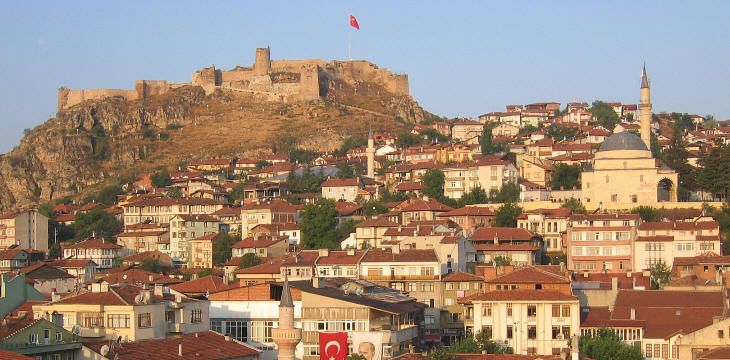
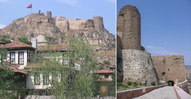
  - Kastamonu - page one - Kastamonu - page one(Ali Pacha Hammam in Tokat) The large fortress which overlooks Kastamonu is a symbol of its long history which was particularly troubled between the XIth and the XVth centuries.
The fortress is thought to have been built by Isaac I Komnenos, Byzantine Emperor from 1057-59, while he was serving as commander of the field army in Anatolia (between 1042 and 1057). The fortress was called Castra Komnenon. At that time the fortress was not meant to protect the Byzantine Empire from an external threat, but rather to strengthen the power of Isaac Komnenos. He was the founder of a dynasty which ruled the empire for over a century. The name of Kastamonu (Greek Castamon) is most likely a corruption of Castra Komnenon.
In 1071 the Byzantines suffered a great defeat at Manzikert; this event, coupled with dynastic quarrels at the court, led to the loss of most of Anatolia to the Seljuks, Turkish-speaking military-organized tribes. Castamon became part of a large principality ruled by the Danishmends, who were based in Amasya and Kayseri. In 1132 Emperor John II Komnenos restored the Byzantines in Castamon, but for just one year because the town fell again into the hands of the Danishmends.
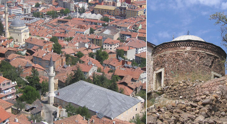
The inhabitants of Old Kastamonu lived on the flank of the hill which was protected by the fortress; Atabey Camii was built in 1273 immediately below the main tower of the fortress. It was meant to be used as Ulu Camii, the great mosque where all male adults gathered for the Friday prayer. Its large roof is supported by many wooden columns. Adjacent to it there is a small circular turbe (mausoleum) with an elaborate brick decoration which retains traces of blue tiles. The view from the fortress also shows two later Ottoman mosques covered by a large dome (Yakupaga Camii) and by a series of small domes (Nasrullah Camii).
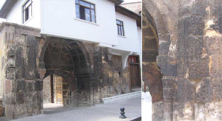
A kulliye (complex of buildings) which included a darussifa (hospital) was built in the same period as Atabey Camii. It has been largely modified but it still retains an original portal decorated with light and elaborate reliefs, a typical feature of Seljuk architecture.
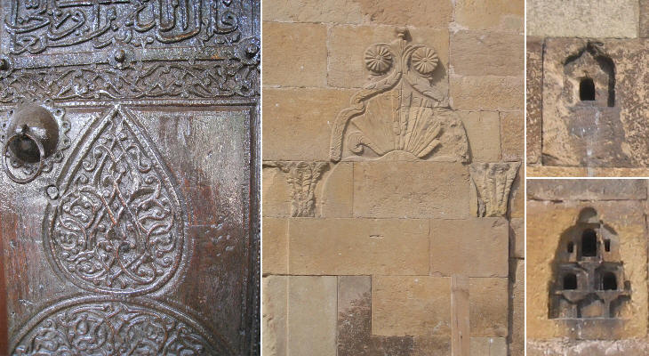
In 1292 Kastamonu became closely linked to the first appearance of the Ottomans in history. In 1291-92 Temur Yaman Candar was the commander of the palace guards of the Seljuk Sultan Murad II: he became involved in a dynastic quarrel and by siding with the winning contender he was rewarded with Kastamonu and its environs. This led to the foundation of an autonomous principality; the dynasty was named Candarogullari after its founder. The governor of Kastamonu had the responsibility to control the border between the Seljuk territories and the Byzantine Empire in north-western Anatolia. The Candarogullari however preferred to cooperate with the Byzantines and they even sided with them against other Seljuk/Mongol principalities. For this reason the Seljuk Sultan entrusted the control of his territories bordering on the Byzantine ones to Osman Bey, the founder of the Ottoman dynasty. Ibni Neccar Camii was built in 1353 and it is the oldest mosque of Kastamonu which belongs to the Candarogullari period. It was damaged by an earthquake in 1943. The mosque is famous for its wooden door panels, which are carved with floral motifs shaped into discs and teardrops. They are now replaced by good copies. The outer qibla * wall is decorated with a relief and there are small niches for birds to nest inside. (*) direction of Mecca which determines the direction of prayers.
Overall relations between the Candarogullari and the Ottomans were good and they were strengthened by the establishment of family bonds. In 1380 as a result of a dynastic quarrel the principality was split into two branches: one was based in Kastamonu and the other in Sinop. A few years later the Kastamonu branch ran into a confrontation with (Ottoman) Sultan Beyazid, who conquered the town. In 1402 Beyazid was defeated at Ankara by Timur, who gave Kastamonu to the Candarogullari of Sinop. In the XVth century the Ottoman Sultan was again recognized as the overall master of the principality, which however continued to be ruled by the Candarogullari. This situation lasted until 1461 when Sultan Mehmet II, after having conquered Constantinople, decided to annex to his empire many small principalities in Anatolia, including Kastamonu and the Empire of Trebizond. Ismail Bey was the last Candarogullari ruler. He built a large kulliye on a mound along the river: it included a mosque, a caravanserai, a medrese, an imaret and his own mausoleum. The design of the complex shows the influence of Ottoman architecture. Ismail Bey was not buried in the mausoleum he built. Sultan Mehmed II, after having taken control of the Candarogullari possessions relocated Ismail Bey to Filibe (Philippopolis, today's Plovdiv) in Bulgaria, where he died shortly thereafter.
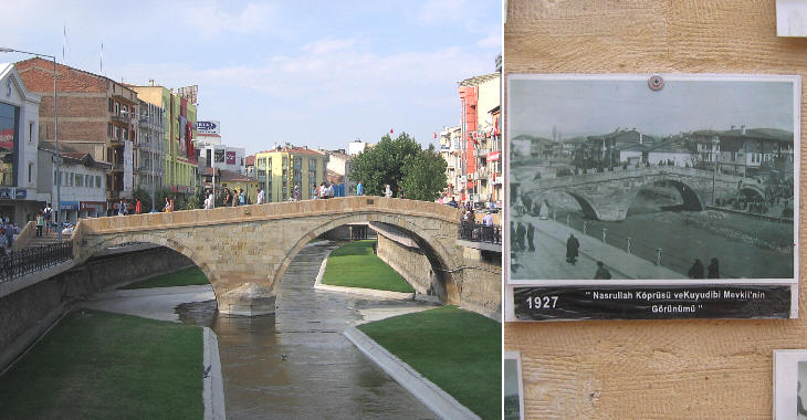
Kastamonu is situated near a small stream which by joining with other small rivers forms the Gok River (ancient name: Amnias). A traditional 1506 Ottoman bridge was among the landmarks of the town. Unfortunately due to the enlargement of the streets along the river it has been brutally shortened.
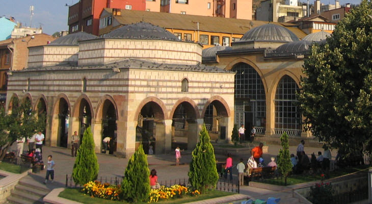
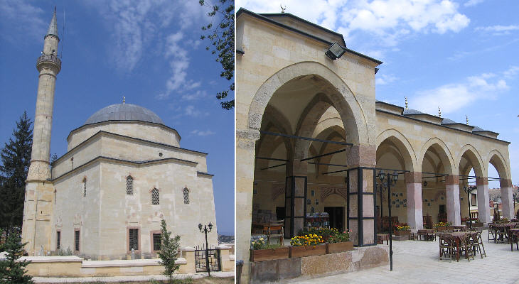
This mosque was built by Nasrullah Kadi (Judge Nasrullah) during the reign of Ottoman Sultan Beyazid II at the same time as the Nasrullah bridge. The mosque was enlarged in 1746 and a few years later the two fountains which served for ritual ablutions were covered with two nice domes which rest on eighteen pillars.
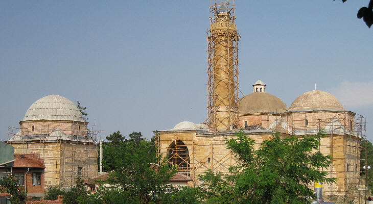
Yakup Aga Kulliye was built in 1547 and it is the best example of Ottoman architecture in Kastamonu; the mosque, thanks to its position on high ground, is a key element of the town's landscape. The ancillary elements of the complex were recently restored after they had been abandoned for some time.
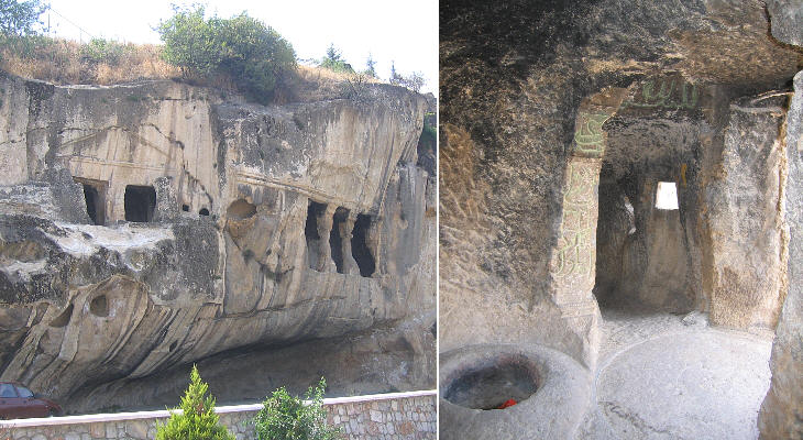
Many locations of south-western Turkey (such as Kaunos and Myra) are renowned for their rock-cut tombs. This kind of funerary monuments can be found also in Paphlagonia (the historical region to which Kastamonu belongs). An impressive tomb is located in a remote area between Kastamonu and Taskopru. Near the town there are two such tombs: from the exterior they have the appearance of a Greek temple, while inside they are not limited to a cell, but have rooms, passages and storage facilities. For this reason they have been called Ev Kaya (stone house). The image in the background of this page shows a relief on a well at Ismail Bey Medresesi. Move to page two. Introductory page Safranbolu Taskopru Amasya Turhal and Zile Tokat Niksar Hattusa and Yazilikaya Clickable Map of Turkey showing all the locations covered in this website (opens in another window).     |
