  What's New! Detailed Sitemap All images © by Roberto Piperno, owner of the domain. Write to romapip@quipo.it. Text edited by Rosamie Moore. Page added in November 2008. |
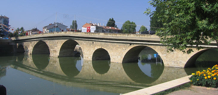
  - Taskopru - Taskopru(Ali Pacha Hammam in Tokat) Taskopru is a quiet town on the right (southern) bank of the Gok Irmak (Blue River). It supplies garlic to the whole country, so at a local restaurant it would not be polite to ask for a dish without its pungent flavour.
Taskopru was founded in the XIIIth century and it was named after the stone bridge built by the rulers of Kastamonu. Apart from the bridge Taskopru does not have old buildings because in 1927 it was almost entirely destroyed by a fire caused by an earthquake. Pompeiopolis
Taskopru is in a way the heir of Pompeiopolis, a town founded by Pompey in 65 or 64 BC on the left (northern) bank of the river. In 67 BC the Senate gave Pompey an imperium infinitum (extraordinary authority) for a period of three years to eradicate the pirates from the Mediterranean coast of today's Turkey. After having achieved this objective, Pompey waged war on Mithridates VI, King of Pontus, a long time enemy of Rome and defeated him. In order to consolidate Roman control over the conquered territories Pompey founded seven towns; his veterans were the first inhabitants.
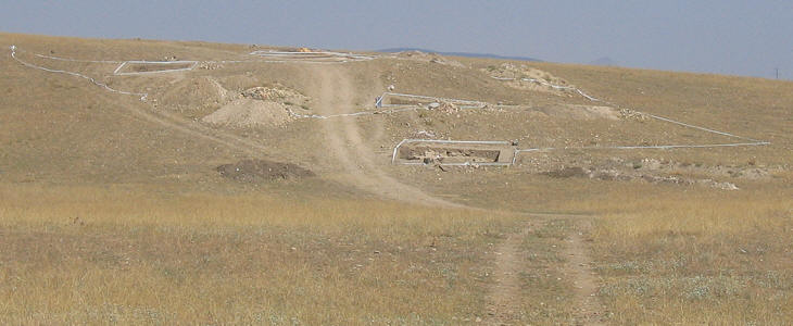
The memory of Pompeiopolis was lost until the French consul at Sinop discovered there an inscription mentioning Pompeiopolis, Paphlagoniae metropolis, Paphlagonia being an ancient name of the region. This occurred in the early XIXth century; in 1910 the site of Pompeiopolis was identified on a hill immediately north of Taskopru. Systematic excavations started in 2006 under the direction of PD Dr. Lātife Summerer of the Institut fur Klassische Archaologie of the Ludwig- Maximilian University of Munchen.
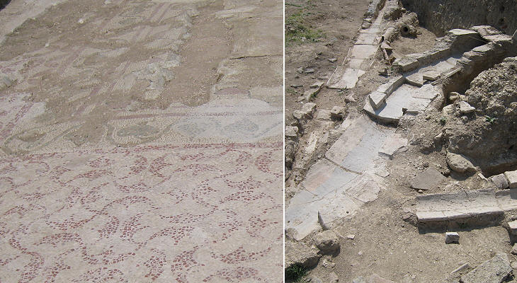
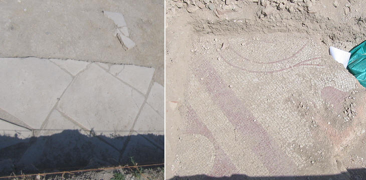
A visit to the archaeological site is very interesting because one can see the process of discovering the structure of the old town, or to be more precise of the "towns", as buildings of the Late Empire period cover the initial settlement. Turkey has archaeological sites which are known worldwide such as Pergamum, Ephesus and many others along the southern coast, but the Roman presence in north-western Anatolia has still to be fully investigated and the excavations at Pompeiopolis are expected to greatly contribute to unearth this historical aspect. Kale Kapi
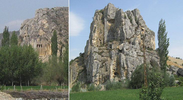
The environs of Taskopru, not only offer the chance to see the excavations of a Roman town, they also allow the discovery of a very ancient rock-cut tomb. Maybe discovery is not the right word, but this is the feeling one experiences when seeing Kale Kapi (Castle/Rock Gate) from a distance.
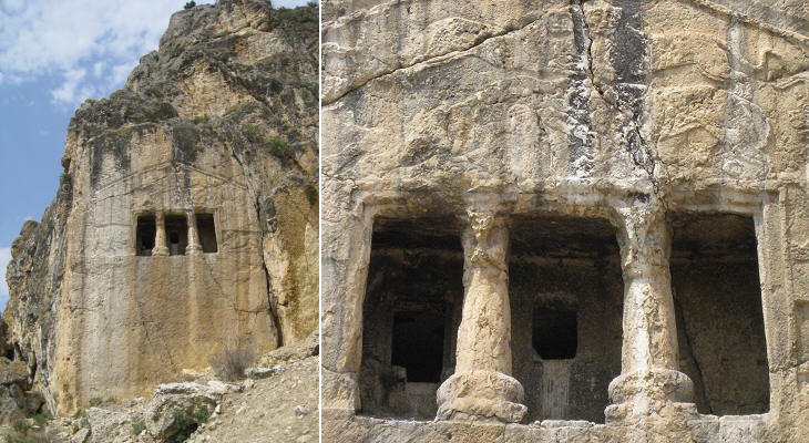
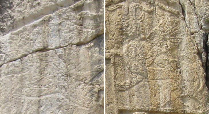
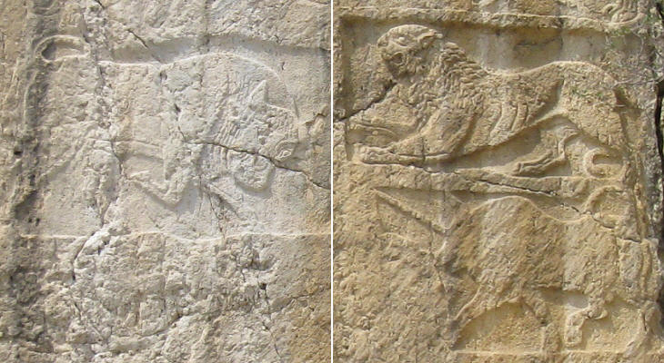
We know very little about the history of Paphlagonia before its conquest by Alexander the Great. It seems that owing to its mountains invaders were not interested in occupying it and that the region was ruled by a local dynasty. It had however contacts with the Greek and Persian civilizations and Kale Kapi clearly shows their influence. The shape of the tomb is similar to a Greek temple and the relief above the cell portrays the fight between a man and a lion, a likely reference to Hercules. The pair of lions above the fight scene indicates that the tomb was that of a king.
Two mythological animals stand at the sides of the central reliefs; that on the left is hardly visible, while that on the right is almost intact. It is difficult to trace back this animal to the Greek myth; its wings remind the viewer of a Persian sphinx.
The tomb is decorated by three more animals; while bulls and lions can be seen in many works of art of antiquity, the unicorn is very rarely portrayed. Unicorns were not part of the Greek myth; they were thought to be actual animals living in India. The unicorn depicted at Kale Kapi has a heavy body which seems similar to that of a bull or of a boar. Boyabat
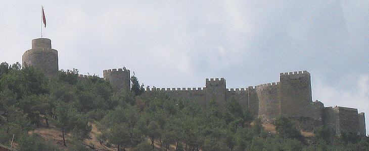
The fortress of Boyabat, some thirty miles east of Taskopru, protected the entrance to the Gok Irmak valley. More images of the fortress can be seen at this external link (opens in another window). Introductory page Safranbolu Kastamonu Amasya Turhal and Zile Tokat Niksar Hattusa and Yasilikaya Clickable Map of Turkey showing all the locations covered in this website (opens in another window).     |
