  What's New! Detailed Sitemap All images © by Roberto Piperno, owner of the domain. Write to romapip@quipo.it. Text edited by Rosamie Moore. Page added in November 2008. |
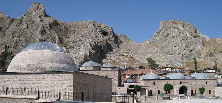
  - Tokat - page one - Tokat - page one(Ali Pacha Hammam in Tokat) Tokat is the heir of Comana Pontica, an ancient town situated on the left bank of the Yesilirmak (Green) River, which was known for a large temple dedicated to a moon-goddess.
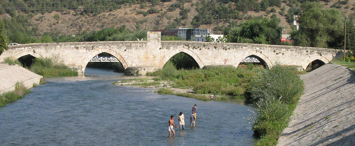
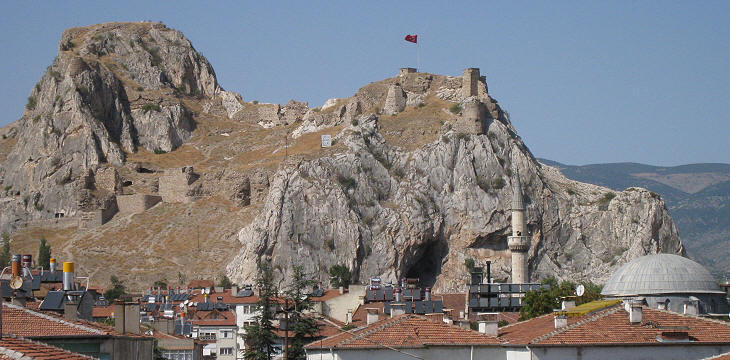
After the Byzantine defeat at Manzikert in 1071, the region was invaded by Turkish tribes; at that time Comana was most likely a very minor settlement and the invaders decided to found a new town a few miles away. They chose a site at the foot of a rocky hill which was situated a couple of miles south of the river; Tokat, the new town, underwent rapid development and a large bridge was built across the Yesilirmak to facilitate access to it.
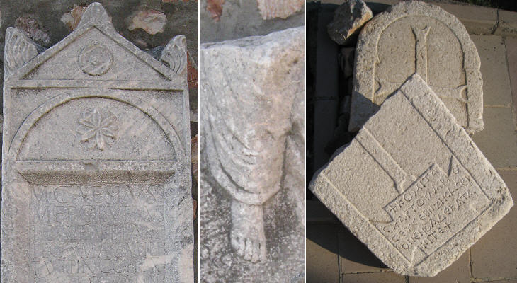
For this reason Tokat does not retain monuments of Classical antiquity: a small museum displays inscriptions and reliefs of that period which were found in the province.
The history of Tokat is similar to that of Amasya: at first it belonged to the Danishmend Emirate and after 1192 to the Seljuk Sultans of Konya. During the XIIIth century it became part of a Mongol Ilkhanate, although formally subject to the Sultans of Konya (between 1250 and 1257 it was part of the Emirate of Kastamonu). Finally it was conquered by (Ottoman) Sultan Beyazit I towards the end of the XIVth century. Current fortifications which link the two peaks of the hill date from the Ottoman period.
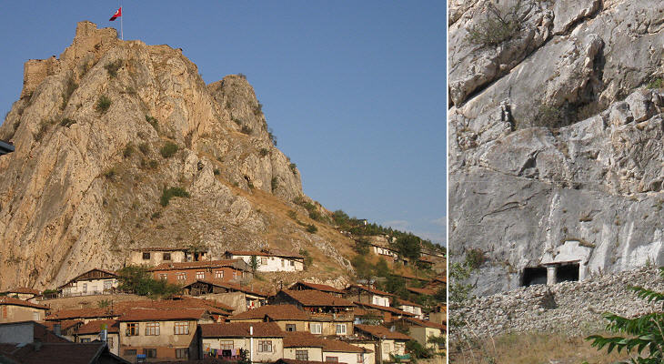
Modern Tokat has developed along a south-north axis along the road leading to the bridge; in the past most of its houses were grouped around the fortress; on the southern side of the hill there is a small rock-cut tomb.
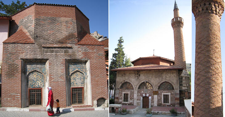
During the Mongol protectorate Tokat flourished as a trading city and pilgrimage centre. The main street of the old town ran along the southern edge of the fortress; it had a variety of markets; there were many caravanserai which were neglected for a long period and are now being restored/reconstructed. The buildings shown above belong to the Ottoman period.
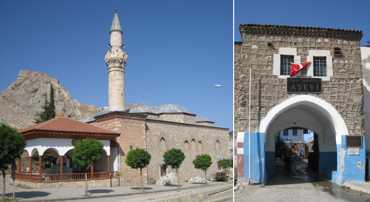
Takyeciler Camii was built in the XVIth century next to a bedesten (covered market). The mosque has been almost entirely reconstructed while the bedesten required minor restoration.
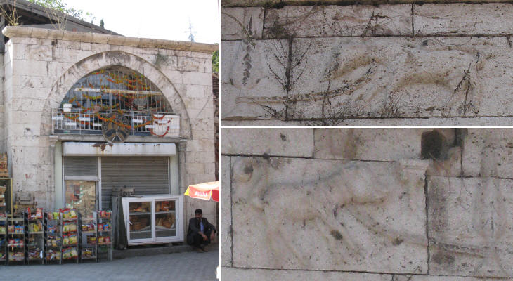
A grocery is housed in the entrance to a caravanserai built in 1752; the portal is decorated with two peculiar reliefs portraying an animal which is chained to a cypress. The locals call it Aslanli (Lions') Hani.
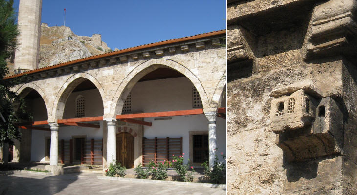
Ulu Camii (Great Mosque) was built by the Danishmend in the XIIth century, but it was modified in 1678. It has some ancient columns and a sort of small cage for birds to nest inside it.
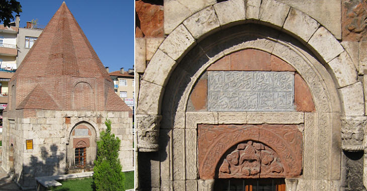
Ebulkasim bin Ali Tusi was a governor of Tokat during the Seljuk period; his kumbet (tomb with a pyramidal roof) is decorated with blue tiles. Mescid means small mosque: Alaca Mescid was built in 1301 when Tokat was part of a Mongol Ilkhanate; Hamza Bey Camii was built in 1411 during the Ottoman Interregnum, when three sons of Sultan Beyazit fought each other.
The finest tomb of Tokat belongs to the Ilkhanate period: it was built in 1314 at a distance from the town, along the road leading to the bridge. The image used as background for this page shows an inscription of this monument. Move to page two. Introductory page Safranbolu Kastamonu Taskopru Amasya Turhal and Zile Niksar Hattusa and Yazilikaya Clickable Map of Turkey showing all the locations covered in this website (opens in another window).     |
