  What's New! Detailed Sitemap All images © by Roberto Piperno, owner of the domain. Write to romapip@quipo.it. Text edited by Rosamie Moore. Page added in September 2009. |
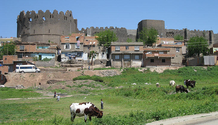
  - Diyarbakir - the walls - Diyarbakir - the walls(relief at Karatepe) Diyarbakir is covered in this and three other pages showing: the gates, Ulu Cami (the Great Mosque) and other monuments.
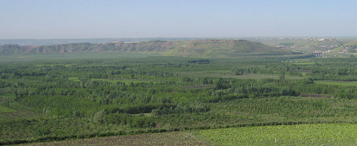
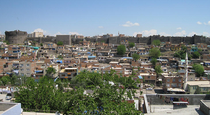
Diyarbakir is located on the right (western) bank of the Tigris (Turk. Dicle) in Upper Mesopotamia. The river is still a relatively minor stream, but it carries enough water for the irrigation of a strip of land along its course. The soil is very fertile owing to its volcanic origin.
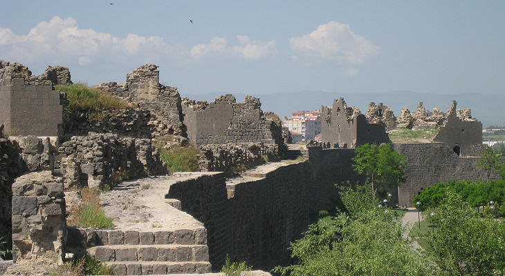
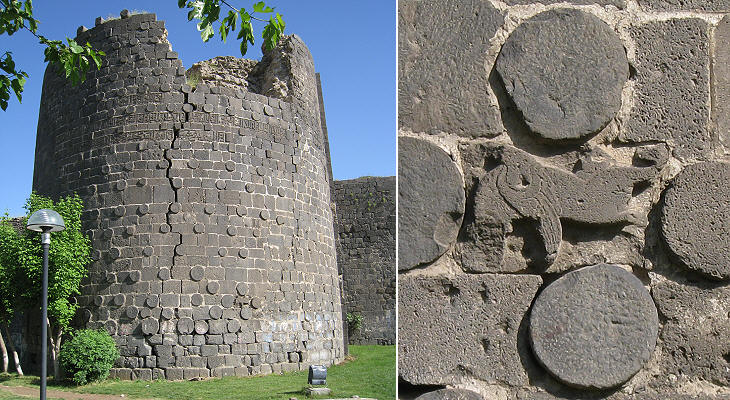
Kara in Turkish means black and karaca blackish; Karacadag (the blackish mountain) is the now extinct volcano near Diyarbakir which (while active) erupted the layer of basalt rock which was used in the construction of the city walls.
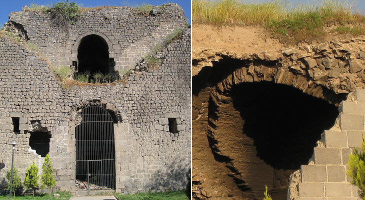
The basalt stones which characterize the walls of Diyarbakir are only the outer surface of an elaborate brickwork structure which included barracks and storage rooms. The walls were initially built in the IVth century AD and they have been modified several times; the original Roman sections can be identified by the presence of layers of thin bricks (see a page on Roman construction techniques).
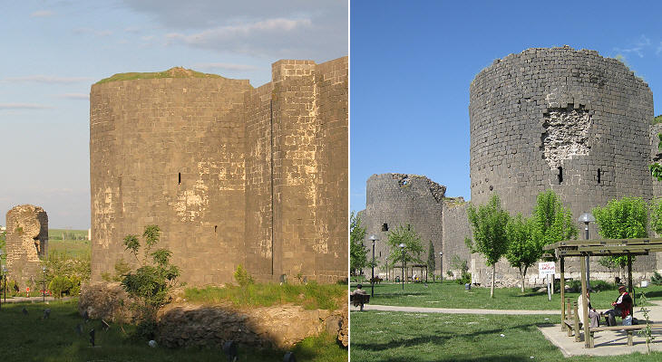
The towers of the walls of ancient Rome (see those between Porta S. Lorenzo and Porta Maggiore) and Costantinopole (see those near Top Kapi) were usually square, round towers being generally limited to those which flanked a gate; many towers of Diyarbakir are round and this is an indication that they were built at a later period.
The XVth century saw the development of cannon in Europe; the Ottomans with the help of Hungarian technicians used very effective artillery in the 1453 conquest of Constantinople; the Ottomans defeated the Safavids and the Mamelukes in the early XVIth century thanks to their technological edge in gunpowder weaponry. The strengthening of some Diyarbakir towers with slices of columns was done by the Ottomans after the town became part of their empire.
The eastern walls of Diyarbakir overlooked the river; they were easily defensible, because they stood on a cliff. It was necessary however to control all the high ground near the river bank so that the enemy was always kept in a difficult position; for this reason in the XIth century a long bastion was built at the south-eastern corner of the walls. It is called the goat bastion because only goats could manage to climb the cliff upon which it was built.
Sir Keppel Archibald Cameron Creswell visited Diyarbakir in the 1920s; he was an expert in Islamic architecture and he left an account of his visit: he so described the southern section of the walls: "The wall follows the edge of a deep ravine full of orchards. In following this ravine the wall comes forward, retreats, and then comes forward again, forming as it were two horns; the tip of each horn is defended by a most magnificent tower." Today the orchards have been replaced by a miserable slum where a foreigner ventures with some fear and comes back feeling compassion for the hardship he saw.
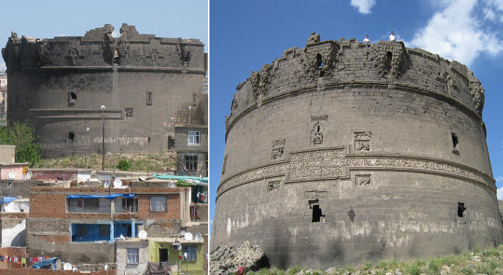
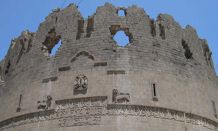
The two magnificent towers described by Creswell are Ulu Beden and Yedi Kardes Burcu. They were built in 1208; at that time Diyarbakir was part of an emirate ruled by the Artukids, a dynasty founded by members of the Turkish tribes who invaded the region at the end of the XIth century. The Artukid territories were divided into three small states; the main one included Mardin and Diyarbakir, a second one was located farther to the east and a third one was centred in Harput.
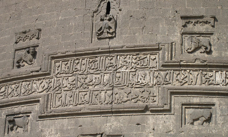
The tower is almost encircled by a monumental inscription in Kufic script. The central part of the inscription is surrounded by reliefs: at the top there is a double-headed eagle, a symbol of power which the Artukids shared with the Seljuks (and with the Byzantine, Austrian and Russian emperors). Two sphinxes and two bulls complete the decoration. The image used as background for this page shows another relief which is placed at the very end of the inscription central line.
The second large tower is located near Mardin Gate; the photo was taken from the old road which linked Diyarbakir with Mardin; this tower and Ulu Beden constituted an actual improvement of the fortifications; their size made them visible from the main road of the country so that they fulfilled also the second objective of celebrating the Artukid rulers.
The decoration of Yedi Kardes Burcu is similar to that of Ulu Beden. The two towers did not help the Artukids in retaining power; a few years after their completion waves of invaders moved into the Artukid states: first Khwarezmian warriors (see a page on Khiva, a town in Khorezm) devastated the country and after them the Mongols imposed their rule over Upper Mesopotamia.
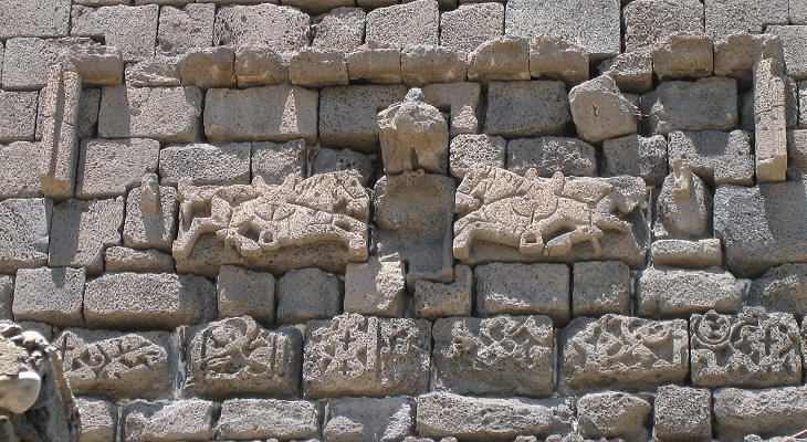
Nur Burcu is situated next to Yedi Kardes Burcu but its decoration dates from an earlier period (1089); it is interesting to note that it focuses on horses, rather than sphinxes, lions and bulls. The Turkish warriors who invaded Anatolia and Upper Mesopotamia in the late XIth century were very able horsemen and they made use of advanced saddles and stirrups which contributed to their victories. Go to: page two - the gates or to page three - Ulu Cami or to page four - other monuments. Move to Introductory page Tarsus Lampron Adana Sis (Kozan) Laiazzo (Yumurtalik) Karatepe Yilanli Kale Gaziantep Kahramanmaras Kilis Birecik Aleppo Cyrrhus Ain Dara Sanliurfa Harran Nemrut Dagi Harput Mardin Silvan and Malabadi Koprusu Map of Turkey with all the locations covered in this website     |
