  What's New! Detailed Sitemap All images © by Roberto Piperno, owner of the domain. Write to romapip@quipo.it. Text edited by Rosamie Moore. Page revised in May 2010. |
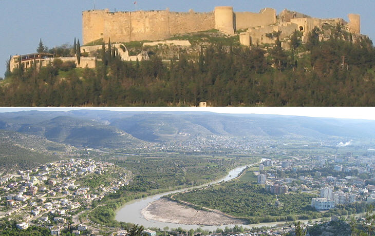
  Silifke Silifke(Kizkalesi) The ruins of the antient Seleucia, now called Selefkeh though nine miles distant were conspicuous from the ship (..). The remains of Seleucia are scattered over a large extent of ground, on the west side of the river Calycadnus. Francis Beaufort, Captain of HMS Frederikssteen, a frigate of 32 guns: Karamania; or a brief description of the South Coast of Asia Minor, and of the Remains of Antiquity collected during a survey of that coast, under the orders of the Lords Commissioners of the Admiralty, in the years 1811 & 1812 - Published in 1817
Seleucia ad Calicadnus, today's Silifke, was founded by Seleucus, a general of Alexander the Great, who, after the death of his commander, ruled over most of Anatolia and Syria. At that time the Calicadnus, the river near the town was navigable. Similar to many other ancient towns, Seleucia was made up of an upper town on a fortified hill (acropolis) and of a lower town along the river with markets and warehouses. The Romans, who conquered the region in the IInd century BC, built a bridge across the Calicadnus; its foundations can still be observed in the current bridge.
The valley of the Calicadnus was important because it allowed communication between the Anatolian tableland and the Mediterranean coast; the upper valley was controlled by a fortress in Mut (ancient Claudiopolis), whereas the lower valley was controlled by the fortress of Silifke. During the Third Crusade, German Emperor Frederick I, Barbarossa led a large army trough the Anatolian tableland, where he sacked Iconium (Konya), before moving towards the coast via the Calicadnus valley. On June 10, 1190, at the age of 67, he drowned while crossing the river.
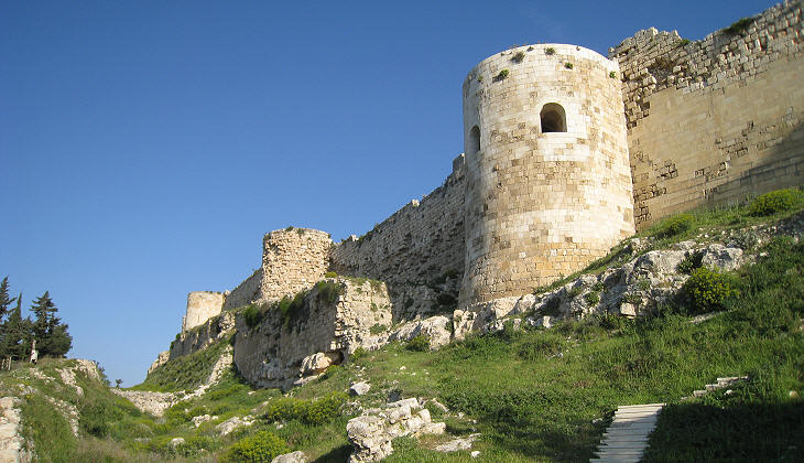
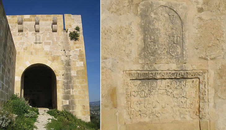
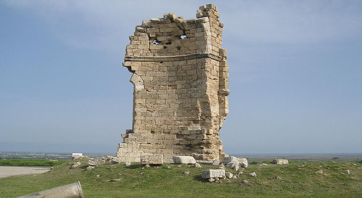
On a hill, west of the town, are the remains of the citadel, of an oval form, surrounded by a double ditch, and a well built wall with numerous towers: the interior is full of ruined houses, among which are many fragments of columns. F. Beaufort The fortress which we see today is mainly a Byzantine/Armenian fortress, with only minor additions made by the Ottomans.
In the late XIIth century Armenian noblemen established a feudal kingdom in Cilicia, a territory which nominally belonged to the Byzantine emperors; by taking advantage of the Crusades, the Armenians managed to control most of the coast between Cilicia and Pamphylia, including Silifke; their kingdom is known as Kingdom of Lesser Armenia.
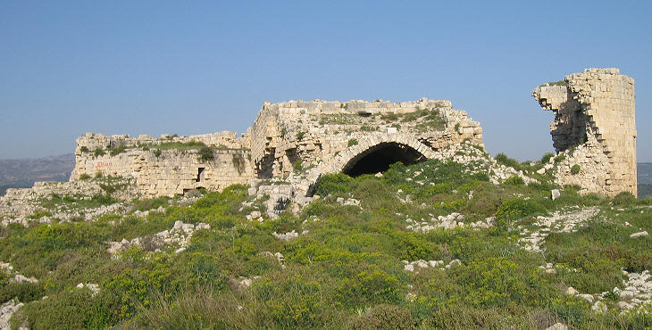
The Kingdom of Lesser Armenia was a loose alliance of local rulers of Armenian descent; they lived in a series of vaulted rooms and halls in the most protected parts of their castles; buildings similar to those at Silifke can be seen at Lampron Castle and at Sis.
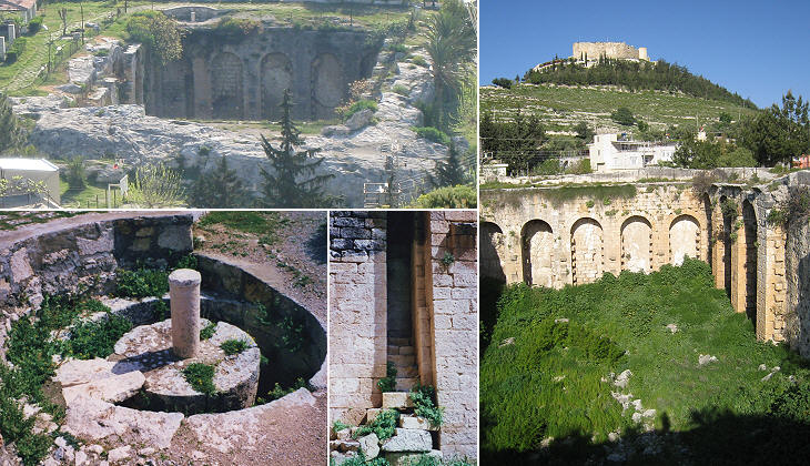
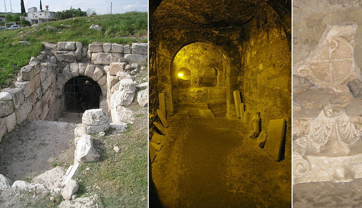
Near the catacombs there is an enormous reservoir, hewn out of soft stone; the roof is supported on parallel rows of square pillars and the sides and bottom are covered with very hard stucco, or terras. Its dimensions are 150 feet by 75, and 35 in depth. F. Beaufort Byzantine Seleucia had a water supply system based on a large cistern at the foot of the acropolis. Pipes led the water to fountains in the lower town.
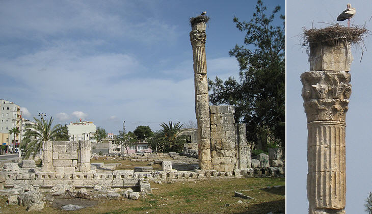
(There is) a temple which had been converted into a Christian Church, and several large Corinthian columns, about four feet in diameter, a few of which are still standing. F. Beaufort Ancient Seleucia had several temples, but only one of them is left and only one column is not broken. The temple was dedicated to Zeus, but today it is commonly referred to as the Temple of the Storks.
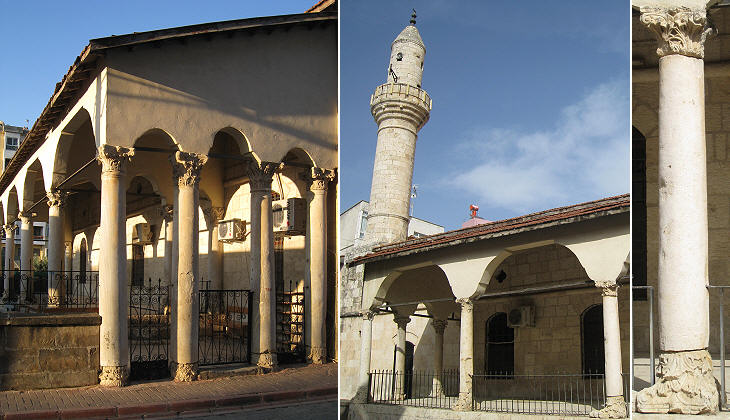
Ancient columns and capitals were used in 1328 for the construction of a mosque; at that time Silifke was controlled by the Emirs of Laranda (Karaman).
According to an apocryphal tradition, Thecla was a virgin who was converted by St. Paul the Apostle; she escaped being killed by hiding in a cave which after her death was turned into a shrine. It is generally thought that Byzantine Emperor Zeno, who was born in the mountains north of Silifke, built in the late Vth century a large basilica above the cave.
 Move along the Coast of the Pirates: Introduction and Alanya Anemurium Mamure Kalesi Olba (UzuncaburÁ) Korykos and Kizkalesi Elaiussa Map of Turkey with all the locations covered in this website. SEE THESE OTHER EXHIBITIONS (for a full list see my detailed index).    |

