

What's New!
Detailed Sitemap
All images © by Roberto Piperno, owner of the domain. Write to romapip@quipo.it. Text edited by Rosamie Moore.
Page added in June 2012.
|
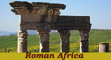 - Ancient Roman Towns in Today's Tunisia - Ancient Roman Towns in Today's Tunisia
(detail of the theatre at Thugga)
In 146 BC, at the end of the Third Punic War,
the Romans destroyed Carthage and established their first province on the southern shore of the Mediterranean Sea; it was called Africa,
a name the etymology of which is uncertain, but which probably meant Land of the Afri, a term indicating the native tribes who lived there prior to the arrival of the Phoenicians who founded Carthage and other towns along the coast.
The new province included only the north-eastern part of today's Tunisia and its capital was Utica, a town the inhabitants of which had helped the Romans to defeat the Carthaginians. In 105 BC the province was enlarged after the Romans defeated Jugurtha, King of Numidia and it included Tripolis (three cities) in today's Libya.

Clickable map of the archaeological sites (blue dots) covered in this section. The red dots (not clickable) indicate towns which are covered in a separate section. The red line indicates the current border between Algeria (left) and Tunisia (right)
Pax Romana is the term used by historians to indicate the long period of peace enjoyed by the Roman Empire between the end of the civil wars in 27 BC and the death of Emperor Marcus Aurelius in 180 AD.
In the Province of Africa this period of prosperity led to the development of many towns in the interior of the country in addition to those along the coast.
Thysdrus (El Djem): House of Africa: mosaic portraying an allegory of the Roman Empire: Rome is depicted at the centre of the mosaic and is surrounded by some of the provinces: (clockwise) Sicily, Asia, Egypt, an unknown province, Africa and Spain. Africa is identified by elephant tusks.
Africa continued to indicate a section of the southern Mediterranean coast and not a continent for many centuries.
The Arabs adopted the Roman term and called Ifriqiya today's Tunisia.
European medieval maps (T maps) which partitioned the world among the three sons of Noah, associated Africa with the land from Morocco to Egypt, whereas the biblical reference to the Land of Ham was limited to the latter.
The Gulf of Tunis and the ancient harbours of Carthage seen from the acropolis of the city
In 146 BC the Romans razed Carthage to the ground, burnt all the ships, killed or enslaved all its inhabitants and according to some historians the city was cursed. Carthage however was located in an excellent position and the Romans themselves started to rebuild it in the Ist century BC and Emperor Augustus made it the capital of the province.
The Mejerda Valley near the mouth of the river at Utica
Turbidus arentes lento pede sulcat arenas
Bagrada, non ullo libycis in finibus amne
victus limosas extendere latius undas
et stagnante vado patulos involvere campus.
Silius Italicus - Punica - Book VI | The turbid stream of Bagrada furrows the sandy
desert with sluggish course; and no river in the land
of Libya can boast that it spreads its muddy waters
further, or covers the wide plains with greater floods.
(Translation by J. D. Duff) |
The wealth of Africa resided in its agriculture. The province was one of the granaries of the Empire and in particular it supplied Rome.
The valley of the Bagrada (Mejerda) River which flows in the north of the country was renowned for its fertility and the fact that the river was navigable from Simitthus to its mouth made transportation of its crops easy.
View of Thugga and of its Capitolium
The growth of the settlements from villages to towns can be traced in inscriptions celebrating the construction of monuments or facilities. At Thugga, the town is referred to as Pagi Thuggensis in an inscription celebrating an arch dedicated to Emperor Claudius. 150 years later an inscription celebrating Emperor Septimius Severus speaks of Civitas Aurelia Thugga. Pagus is the Latin word for country district, whereas civitas indicates a town the inhabitants of which had Roman citizenship. This event at Thugga and other towns was celebrated by erecting a Capitolium, a temple dedicated to Jupiter, Juno and Minerva, the three deities which were worshipped in the Capitolium of Rome.
Thuburbo Majus - Ruins of the amphitheatre (left) and of a great cistern (right)
Although their economy was based on agriculture, the towns of Africa had all the facilities typical of an urban settlement: paved streets, aqueducts, fountains, baths, tribunals, marketplaces, theatres and amphitheatres. A network of roads linked the towns of the interior with Carthage and other ports.
Musti - Arch to Gordianus and Mausoleum of Julii
Entrances to towns were often identified by triumphal arches. In addition to their celebratory purpose they indicated the limits of the urban settlement for some practical aspects such as the prohibition to wear arms and to build tombs. They were not gates of a fortification system, because the towns did not have walls. Roman Legion III Augusta was stationed at Theveste, a town just across the border with Algeria, from which it prevented desert nomadic tribes from entering the province.
Sufetula - The forum turned into a Byzantine fortress
At the beginning of the IVth century, as a reaction to the persecution of Emperor Diocletian, many Christians of Africa embraced Donatism, a local church supporting a rigorous vision of Christian values in contrast to those who looked for an appeasement with the Roman State.
It was the beginning of a religious and ethnic split among the inhabitants of the province which eventually facilitated the invasion of the Vandals, a Germanic tribe, in 439.
Africa was conquered by the Byzantines during the VIth century. In order to protect the inhabitants of the towns they turned the forums into small fortresses; they did so in a hasty way by pulling down all the buildings around the forum and by using them as construction material. This did not prevent the Arabs from conquering the whole province at the end of the VIIth century.
Roman tomb at Simitthus
The monuments of the Roman period in today's Tunisia can be found in different settings. The Arabs destroyed Carthage and used the columns of its churches/temples to build a large mosque at Tunis. Some towns did not disappear and foundations of Roman buildings can be seen in the heart of the medina, as it occurs at Le Kef, ancient Sicca Veneria. Thugga and other towns went back to being small villages of peasants and their ruins are often surrounded by farms.
In general ancient monuments are included in archaeological parks, but it is not unusual to see them immersed in a very rural environment.
Mactaris - Arch to Emperor Trajan
The images which illustrate this section were taken in April 2012. Those which illustrate this page were chosen with the intention of paying tribute to Spring and its symbolic meaning.
The image used as background for this page shows the aqueduct which brought water to Carthage from Ziqua.
Move to:
Bulla Regia
Carthage
Mactaris
Musti
Neapolis
Sicca Veneria
Simitthus
Sufetula
Thuburbo Majus
Thugga
Thysdrus
Uthina
Utica
Ziqua
Mosaics in the Museum of Bardo

SEE THESE OTHER EXHIBITIONS (for a full list see my detailed index).
  
|


