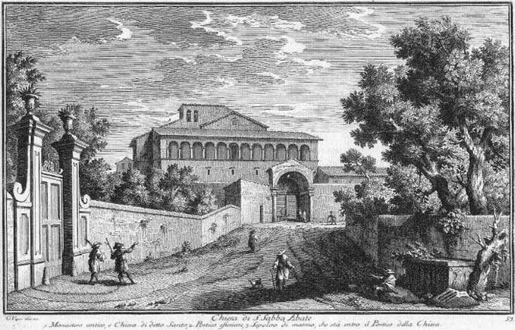
What's New! Detailed Sitemap All images © by Roberto Piperno, owner of the domain. Write to romapip@quipo.it. Text edited by Rosamie Moore. Page revised in June 2009. | S. Sabba Abate (Book 3) (Map C4) (Day 5) (View C11) (Rione Ripa)
In this page:
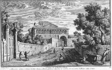
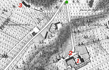
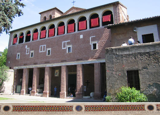
During the Middle Ages and until the end of the XIXth century S. Sabba (S. Saba today) was almost the only building on this peak of the Aventine; this explains why it gave its name to the surrounding area. The view is taken from the green dot in the small 1748 map here below. In the description below the plate Vasi made reference to: 1) Monastery and church of S. Saba; 2) External porch; 3) Sarcophagus in the internal porch of the church (not shown in the map). The map shows also 3) Rovine delle Mura Serviane.
Today
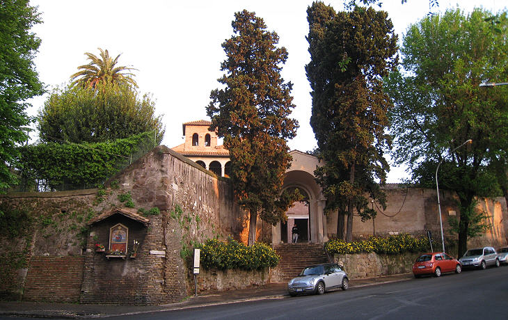
The view of the final part of the street leading to the church is very similar to that of the etching; the area around the church is no longer occupied by vineyards and kitchen gardens, but overall the neighbourhood retains a very peaceful atmosphere. You may wish to have a stroll in S. Saba. The Church
The church is of great antiquity, but it was almost entirely rebuilt by Cardinal Francesco Piccolomini during the pontificate of his uncle Pope Pius II. You see his coat of arms in the image used as a background for this page. The portal retains an inscription and a mosaic decoration of the late XIIth century. You may wish to see the building as it appeared in a 1588 Guide to Rome: its portico had six nice ancient columns which in the XVIIIth century were replaced by brick pillars.
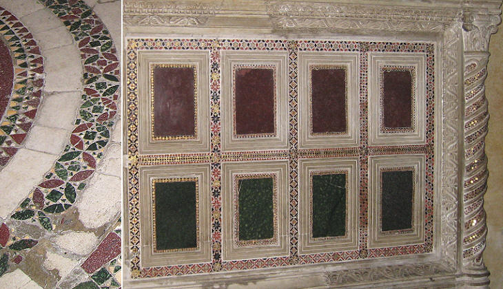
St. Sabba (439-532) was a Greek monk who founded several lavra in Palestine, a lavra being a community living in small caves or cells around a chapel and a refectory; the most famous of them is the Great Lavra known as Mar Saba near Bethlehem in the West Bank. In the VIIth century Palestine was first occupied by the Persians, then retaken by the Byzantines and eventually it was invaded by the Arabs. It is likely that monks who fled from the devastations of that country founded the first church/monastery on this part of the Aventine. Towards the year 1000 with the deepening of the rift between Rome and the Greek Orthodox world, the monastery was assigned to the Benedictines and later on to (Benedictine) monks from Cluny, who restored the church and embellished it with frescoes and cosmatesque decorations.
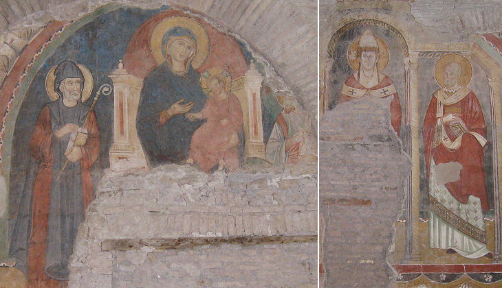
The church had an unusual "fourth nave", smaller than the others; at a certain point it was closed and only in the early XXth century its frescoes were uncovered. The Sarcophagus
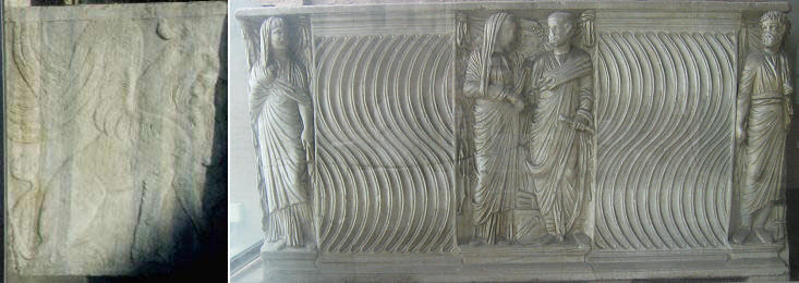
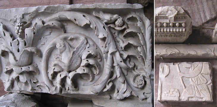
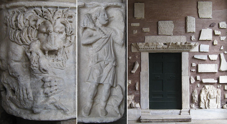
Vasi shows a sarcophagus on the right side of the plate but he explains it is in the portico. It's still there: it represents a wedding. On the smaller side there is a strange animal of oriental origin. The decoration of the sarcophagus is called strigilato after the shape of strigilis, a tool used by the ancient Romans after exercise or massage to take away sweat or oil.
The sarcophagus is part of a small collection of items found in the area surrounding the monastery; by looking with attention at them one can discover some very interesting details (another medieval relief is shown in a page of the abridged history of Rome).
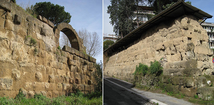
Rovine delle Mura Serviane
Ancient Rome had three sets of walls: a) the wall built when Rome was founded by Romulus on April 21, 753 BC (the Romans counted the years ab urbe condita from this date). The walls were later on incorporated into the palaces built on the Palatine; b) the Servian Wall named after Servius Tullius the sixth king of Rome, but most likely built during the Republican government of Rome in the IVth century BC. They surrounded the seven hills of Rome; c) the Aurelian Wall (see map) built in AD 275 by Emperor Aurelianus and to a great extent still in place. The valley between the two peaks of the Aventine retains one of the two remaining stretches of the Servian Wall (the other is Aggere Serviano). This section was most likely restored in the Ist century BC during a period of civil strife. The wall shows the arched opening of a ballista room from which stones were thrown on the assailants. These walls were near Porta Raudusculana a (lost) gate which was strengthened with bronze plates. Excerpts from Giuseppe Vasi 1761 Itinerary related to this page:
Next plate in Book 3: S. Prisca Next step in Day 5 itinerary: S. Prisca Next step in your tour of Rione Ripa: Monte Testaccio |