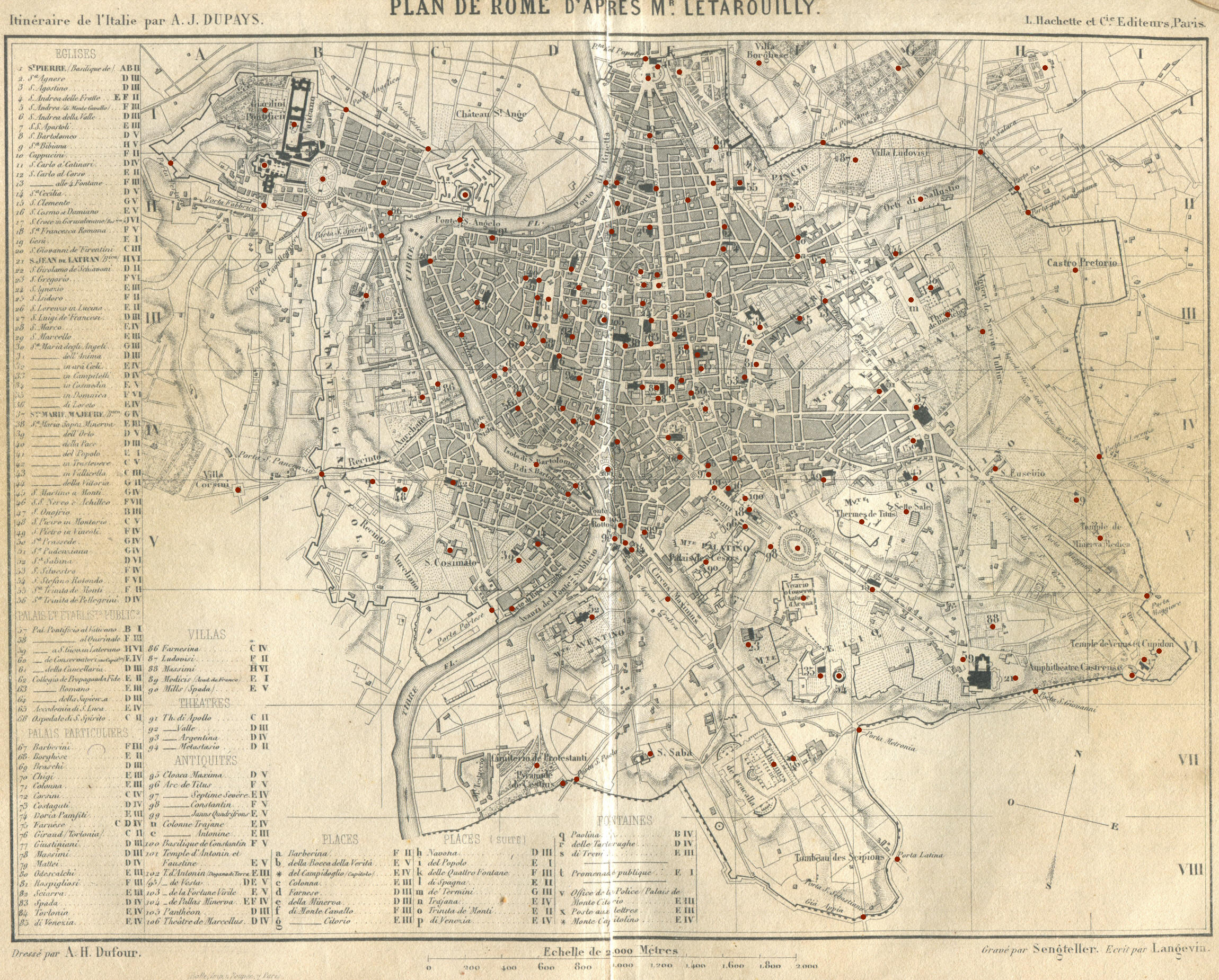
1852 Map of Rome
This map of Rome was included in an 1852 French Guide to Rome and it is based on a larger 1841 map by Paul-Marie Letarouilly. By clicking on the dots you can reach a page where the palace/church/square is shown in association with an etching by Giuseppe Vasi.

Return to the introductory page to this map.
A view from the Gianicolo Hill
can complete your analysis of XIXth century Rome.
For an earlier map of Rome see Giuseppe Vasi's 1781 Map of Rome.

Go to my Home
Page on Baroque Rome or to my Home Page on Rome
in the footsteps of an XVIIIth century traveller. See the latest additions to these websites!
All images © by Roberto Piperno, owner of the domain. Write to romapip@quipo.it. Text edited by Rosamie Moore. Page added in January 2011.


![]()