  What's New! Detailed Sitemap All images © by Roberto Piperno, owner of the domain. Write to romapip@quipo.it. Text edited by Rosamie Moore. Page revised in May 2015. |
  - Egirdir - Egirdir(Heroon at Sagalassos) You may wish to read an introduction to this section first.
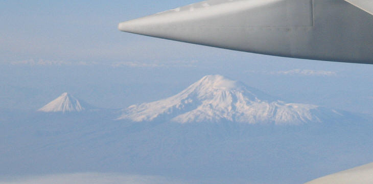
Mount Ararat is the tallest peak of Turkey; its elevation is estimated to be 5,137 m/16,854 ft. It is located at the far east of the country, very near its border with Iran and Armenia. The mountains which surround the Anatolian tableland are not as high as Mount Ararat, yet the Taurus Mountains which lie along the Mediterranean Sea have peaks which reach 10,000 ft. These mountains protect the coastal plains from the cold winds which come from the north.
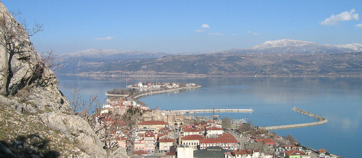
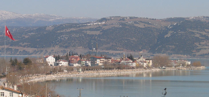
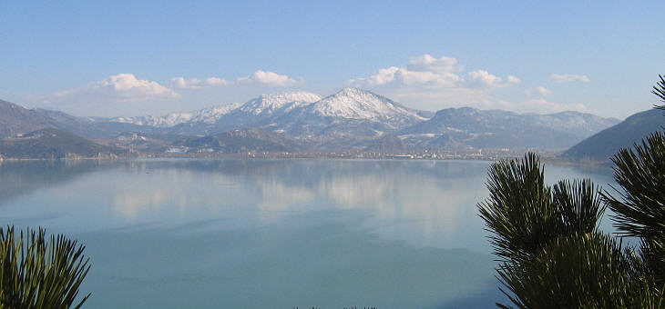
The view of the lake of Eyerdir is indescribably beautiful and may compare with any of the celebrated lakes in Italy. A small island well wooded with poplars and other trees was in front of our resting place. Behind at a short distance rises a mountain. (..) On either side rose more distant ridges peaked and beautifully coloured. Francis Vyvyan Jago Arundell - Discoveries in Asia Minor - 1834 Egirdir Golu is a freshwater long and narrow lake named after the town of Egirdir. It is situated at an altitude of 900m/2,700ft. Egirdir is a modern Turkish adaptation of Akrotiri (steep mountain), the town's Greek name.
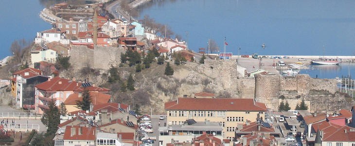
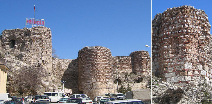
A rock which blocked the passage to a short peninsula was fortified by the Byzantines. It is likely that the early inhabitants of Egirdir came from a nearby ancient town called Prostanna which was mentioned by Ptolemy and in a list of bishops attending the 381 Council of Constantinople.
Egirdir flourished under the Seljuks and in 1280 Felekeddin Dundar Bey, the leader of a Turkish tribe (Hamidogullary) made it the capital of a small principality. He also renamed the town Felekabad, but the name did not last. In 1417 the Ottomans took control of Egirdir, which in the following centuries lost most of its importance.
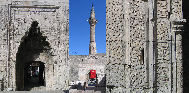
Egirdir was located along the route leading from the Aegean coast to Konya and Central Anatolia; the Seljuks built a caravanserai and a warehouse outside the walls of the town. These were converted into religious buildings by the Hamidogullari rulers; the caravanserai became a medrese (a Koranic school) and the warehouse a large mosque; a new caravanserai was built on the route to Konya.
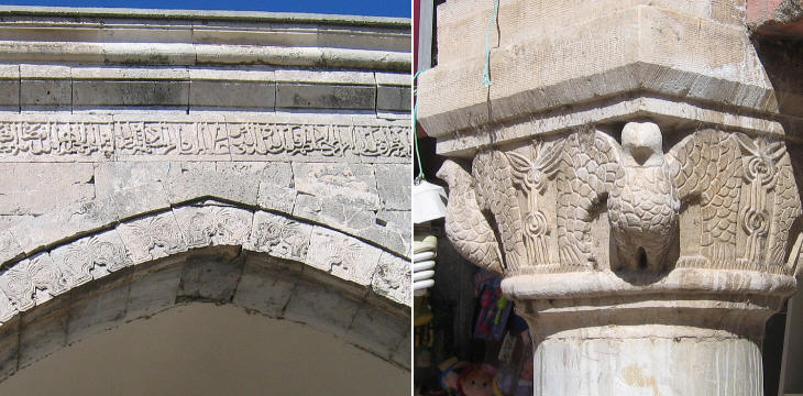
The mosque on the left especially has a gate of extreme beauty, covered with ornaments, and an inscription in Cufic running all around it. (..) The disposition of the edifice (has) pointed arches, supported by pillars, the capitals of which are the very prototypes of what are seen in our oldest churches. Two had birds with extended wings; others with grotesque figures, and one with leaves. F. V. J. Arundell, chaplain of the British community at Smyrna. The Muslim prohibition against life-like imagery of all living creatures led to the development of an art based on calligraphy and geometric patterns. Yet the Seljuks (and after them the Ottomans) were not so strict about this aspect of Islam. It is not unusual to see reliefs and statues portraying animals, in particular birds, even inside a religious building such as a medrese.
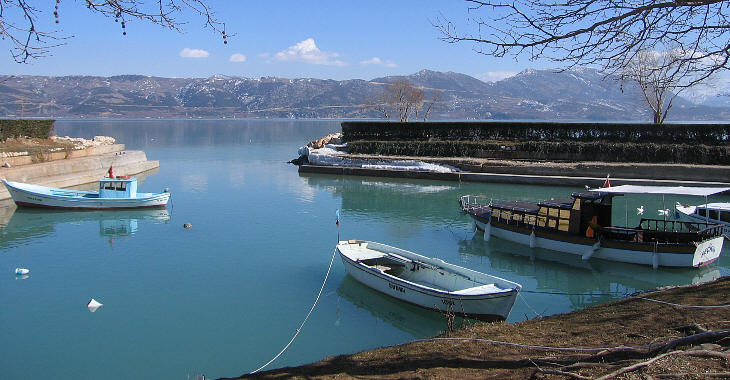
A Greek Orthodox community lived on a small island linked by a causeway to Egirdir: its members had to leave in the 1920s when Turkey and Greece agreed on a vast exchange of population. There were fourteen churches, only one of which (Ayastefanos) still exists; it is deconsecrated and apparently nothing indicates its former use apart from a tourist signpost with its name.
The island has now many restaurants offering the fish of the lake; in winter the lake has a very Alpine appearance with snow-capped mountains all around.
Introductory page Afyonkarahisar Isparta Kutahya Sagalassos Map of Turkey with all the locations covered in this website     |
