  What's New! Detailed Sitemap All images © by Roberto Piperno, owner of the domain. Write to romapip@quipo.it. Text edited by Rosamie Moore. Page added in July 2007. |
Everyday a train leaves Termini at 8:14; first stop: Orte; second stop Narni; third stop Terni; fourth stop Spoleto; fifth stop Trevi; sixth stop Foligno; seventh stop Spello; eighth stop Assisi; last stop ...  Perugia - part one: the walls Perugia - part one: the walls
The train leaves Assisi and heads north-west; in a few minutes it crosses the River Tiber and soon after it reaches its final destination: Perugia.
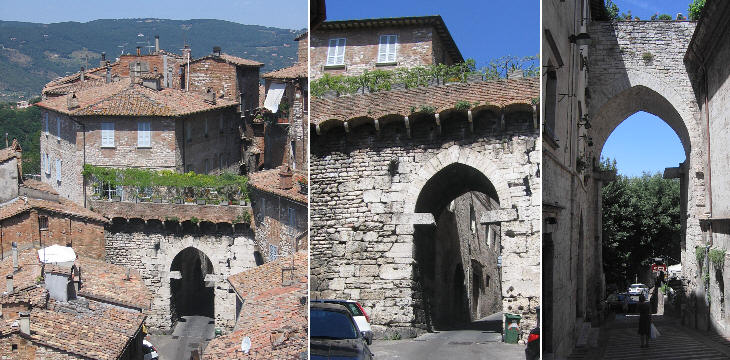
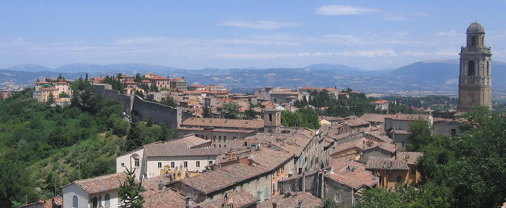
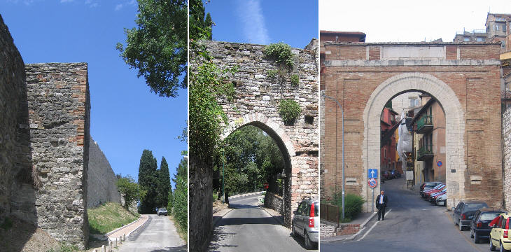
Due to its location near the River Tiber valley and at one end of the Umbrian Valley, Perugia was inhabited from prehistoric times. Its position on a hill was due not only for defensive needs, but also for health reasons because the plain had plenty of marshes. Life improved when the Etruscans achieved control over the territories to the west of the Tiber, including Perugia. They dug a canal which facilitated the flow of the Umbrian Valley streams into the river. The Etruscans were the most advanced people of pre-Roman Italy and they developed construction techniques based on the use of arches and vaults. Some of the gates of Etruscan Perugia were narrowed during the Middle Ages and their round arches were turned into pointed ones.
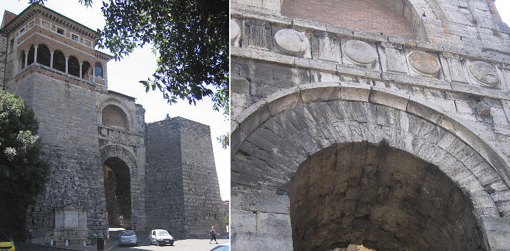
The best preserved Etruscan gate is located on the northern side of the town; it was protected by two imposing towers. The ridge of a nearby hill provided potential enemies with a good attacking position, so the Etruscans strengthened that part of the walls. In 41 BC Lucius Antonius, the younger brother of Mark Antony, tried to stir up a revolt against Octavian: he was forced to retire to Perugia with the senators who supported him: Octavian laid siege to the well protected town and it took him seven months to seize it: Perugia was set on fire, the senators were put to death, but Lucius Antonius's life was spared: the time for open war between Octavian and Antony was yet to come. A few years later Octavian, by now Augustus, promoted the reconstruction of Perugia and gave it his honorific title which can still be read on the gate: Augusta Perusia.
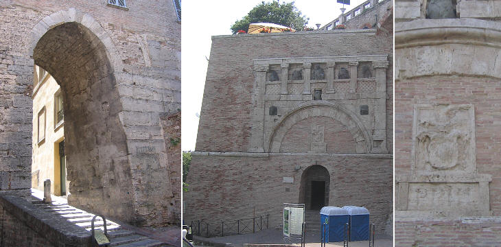
In 1540 another conqueror of Perugia decided to leave his mark on the ancient gates of the town. Pope Paul III Farnese restored papal authority in Perugia defeating the Baglioni, local rulers whose audacity led them to slay a papal legate: Perugia was plundered by the mercenary troops of Pier Luigi Farnese, the son of the pope. Pope Paul III ordered Antonio da Sangallo the Younger to build a fortress (Rocca Paolina) above the houses of the Baglioni: its objective was to ensure the town would never try to challenge his rule again: Rocca Paolina was not meant to protect Perugia from external enemies as an inscription on its walls clearly stated: ad coercendam Perusinorum audaciam (to restrict the boldness of the inhabitants of Perugia). The town was also deprived of many of its trading and self-government privileges. Antonio da Sangallo included Porta Marzia, an old Etruscan gate, in one of the fortress bastions. The citizens of Perugia never forgot the harsh treatment they received from Pope Paul III and in the XIXth century the symbols of that pope were erased; his memory however survives on a gate which is still named after the fleurs-de-lys (gigli), the heraldic symbol of the Farnese, which once decorated it.
For centuries the Etruscan enclosure was large enough to contain the whole population of the town: after the year 1000 Perugia, as most of Europe, started to enjoy a period of growth: the controversies between the Papacy and the Empire helped Perugia in developing forms of self-government aimed at improving trade and manufacturing: the prosperity of the town attracted many farmers who settled outside the ancient walls. Towards the end of the XIIIth century new walls were built to enlarge the town: because the Etruscan ones were almost on the very edge of the hill, the expansion took place on the ridge of two nearby hills: Borgo S. Angelo to the north and Borgo S. Antonio to the east.
Notwithstanding their inclusion in the new walls of the town the two burgs maintained for centuries their characteristic of being populated by the lower classes, as the most important families of Perugia preferred to live in their towers (later on palaces) near the town main squares.
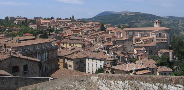
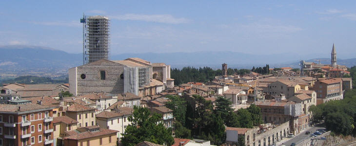
The medieval town expanded also southwards on the slope leading to the river and in the direction of Rome. At first the expansion was limited: new walls protected a gigantic complex built by the Dominican Order (the monastery houses a very important archaeological museum); later on (during the XVth century) the new burg was enlarged to reach S. Pietro (you can see its bell tower to the far right of the photo).
The new walls were far less imposing than the ancient ones: their thickness is perhaps one third of the Etruscan ones: maybe for this reason the old enclosure was retained and the town relied on it for a last defence: the medieval gates were rather simple: some of them were rebuilt in the late XVIth century and were given a shape reminiscent of that of Arco Etrusco.
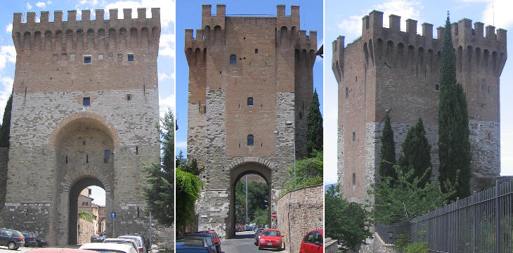
The only major fortification of the medieval walls was a gate at the end of Borgo S. Angelo. Cassero is usually translated as quarterdeck, but it also means the upper part of a fortification. It was built in the XIVth century, but it was strengthened by Braccio Fortebracci, a famous captain of fortune who ruled over Perugia between 1416 and 1424, at the time of the Great Schism. Move to part two: the main squares. 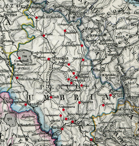
1864 clickable map of Umbria |
